
Indiana Neighbors Around One Address
Start with a parcel, not a roster of everyone nearby. County maps show lots around an address; assessor cards name titled owners; recorder indexes trace legal transfers. Civic and historic sources add context, but none gives a full picture of everyone connected with a block. Each route below answers a narrower question.
| Source | What It Shows About a Block | Access |
|---|---|---|
| GIS parcel map | Parcel shapes, identifiers, address points, nearby lots, selected layers | County viewer or IndianaMap; owner cards may be linked. |
| Assessor cards | Titled owner, mailing and situs addresses, legal description, parcel facts | County assessor/auditor portal or counter. |
| Recorder index | Ownership chronology and legal descriptions | County index, vendor, public terminal, or recorder counter. |
| IndianaVoters | An individual’s registration and polling details | Self-check; voter-file requests follow statutory channels. |
| Permit or code record | Address-linked work, service, or case dates | Local city/county portal or a particular public-record request. |
| Registered-organization directory | Public organization type, boundary, and contact information | City directory or registration system; no member list implied. |
| Library directory | Past named residents or businesses at an address in a given year | State or local library, print, microfilm, or digitized collection. |
| Civic or faith group | Published meeting or community contact details | Organization or library source; membership is private. |
For your Indiana neighbors, the map shows nearby lots and the property card shows whose name appears on each assessment record. Civic directories map groups; library volumes may show an older address entry. Keep those results separate from any claim about current occupants.
Map Indiana Neighbors by Parcel
Start from one address in local GIS, select its address point or parcel, and turn on parcel, address, and street-centerline layers. Pan to lots that share a boundary. Some county viewers offer identify, buffer, radius, rectangle-select, or parcel-neighbor tools; otherwise compare shapes and note each parcel ID. A map shows where land meets, not who is inside a building.
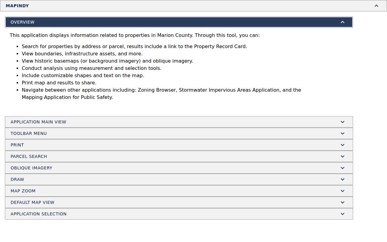
The MapIndy help page shows address search, parcel selection, measuring, and adjacent map navigation in the Indianapolis/Marion County model:
Compare each nearby parcel number and legal description with its assessor card. Date the map view because address points and layers can change.
- Save the starting parcel number, address point, legal lot, and date viewed.
- Mark only parcels that share a boundary, and note when a road, alley, drainage strip, rail line, or gap sits between them.
- Open each selected parcel card separately and record the owner, situs line, mailing line, and legal description as distinct fields.
- Use the Indiana street directory when the question moves from the immediate block to a full street and its deed trail.
MapIndy’s measurement and selection tools help document distance and shape, but a GIS outline does not settle a legal boundary. The recorder or survey controls that question.
This creates a parcel view around one address without treating lot owners as the only people nearby.
Indiana Parcel Records and GIS Layers
IndianaMap helps when an address search crosses county lines. Its statewide parcel layer comes from county data harvest, and counties remain stewards of the underlying information. The Indiana Geographic Information Office’s 2025 release describes parcel and boundary datasets, not a replacement for a local assessor or recorder.
This distinction matters for block maps. Use the state layer for orientation, then return to the county card for a current parcel detail and to the recorder or survey for a legal boundary or ownership change. If the map and tax card differ, save the parcel ID and ask the county which record is current.
Indiana Owner Records and Occupants
An Indiana assessor card may show the owner of record, situs and mailing addresses, tax district, legal description, value, transfer history, sketch, and property details. The owner may be a person, business, trust, or estate; the mailing line is where tax notices go, not who lives there.
A homestead deduction shows a qualifying claim, not current presence or the full set of people at an address. A parcel may be a school, church, business, public space, or multi-unit building. Follow the deed for a legal transfer, and keep property facts separate from household facts.
Indiana Voter Records Across the Block
IndianaVoters asks for a person’s first name, last name, date of birth, and current registration county; an Indiana driver-license number is optional. It can confirm an individual’s registration status and polling information. Its county, precinct, and split-precinct browse features describe election geography, not a public list of everyone at a street address.
A county voter-file request uses a separate statutory channel. Form VRG-24 requires an eligible requester category and identifies county-wide, township, precinct, voter-history, registration, or walking-list products. Restricted statewide copies redact date of birth and gender; qualifying subscribers have a separate annual file route. This is not a casual way to get a block list.
VRG-24 also asks for the requester’s printed name, signature, address, telephone, payment, and selected data product. The categories include political-party and candidate committees, qualifying news media, and a form-specified “other” route. County handling, fees, and use rules still apply.
Participants in the Indiana Address Confidentiality Program may ask the county to flag a record. Their identifying details are withheld from ordinary inspection and copying, with narrow legal exceptions. Do not seek or share protected fields.
Indiana Neighbors and Civic Contacts
Indianapolis/Marion County is the research model for community directories, not a statewide organization registry. The city’s Registered Organizations system maps neighborhood and civic groups and can list a public boundary and contact details. Its form asks for group type, name, meeting frequency, newsletter, contact role, a rough map, north/south/east/west boundaries, township, and bylaws. It supports public notices; it does not release a member roster.
These public channels help identify a group or find a meeting notice:
| Indianapolis-Area Resource | Useful Public Detail | What It Does Not Provide |
|---|---|---|
| Registered Organizations directory | Organization type, mapped boundary, and contact or meeting information where listed. | A complete list of people at each address. |
| Indianapolis Neighborhood Resource Center resources | Points to the Registered Neighborhood Database and community resources. | A release of private association membership. |
| Marion County Alliance of Neighborhood Associations archive | Public meeting archive and civic context. | A directory of every block or household. |
| Nora-Northside Community Council | Published forum and community information for its area. | A statewide association list. |
These are Marion examples, not an Indiana-wide association directory. Elsewhere, check the city or town, library, township, or historical society for boundary and meeting information. A public contact does not make a voluntary roster public.
Indiana Neighborhood Records Across Eras
Different Indiana areas leave different trails. Older Indianapolis blocks may have street numbers, ward references, and Polk maps; postwar suburbs use subdivision plats and parcel IDs; rural counties may rely on township records, plat books, church records, and county histories.
Match a present street to an old plat by lot and block or legal description. Historical volumes may use initials, married names, abbreviations, or old street labels. They show how a place was described in that year, not who is there now. For current boundaries, use a local map or community resource.
Indiana Official Rolls and Directory Tools
Official county records and commercial neighbor-lookup products serve different roles. A parcel card points to the county property record, and a recorder index points to filed instruments. A commercial summary can combine data across places but may merge similar names or keep stale links. Neither is a complete live list of a block.
Compare the source against the question before relying on a name:
| Source Category | Strongest Use | Important Limit |
|---|---|---|
| Official assessor, GIS, or recorder record | Parcel location, titled owner, legal description, or filed transfer from the responsible county. | Does not show every person at the address; access and fields vary by office. |
| Public civic organization source | Area boundary, group type, public contact, meeting notice, or community history. | Does not imply a membership list or household roster. |
| Commercial neighbor-lookup category | A cross-source lead that may point to another record to verify. | May be stale, combine same-name people, or include associations that the official source does not confirm. |
Use the county map or instrument as primary evidence and verify a questionable commercial entry with its custodian. A compiled name is only a lead.
Where Indiana's Block Search Ends
Indiana has no universal block-level voter browser, neighborhood-association directory, or municipal permit system. Route by address: county GIS or assessor for parcels, recorder for deeds, city or town for permits and community boundaries, and library for older directories. Indianapolis/Marion County is a model; other counties use their own tools.
The Indiana county directory routes to county government links. If an index is missing, ask the office for a particular existing file. Under the Access to Public Records Act, agencies need not create a new list; an oral or in-person request gets a response within 24 hours, and mailed, emailed, or faxed requests within seven calendar days. Production takes a reasonable time.
For community boundaries, ask a local library, town office, township, or historical society. Statewide research does not supply county-specific contacts.
Indiana Neighbor Privacy at the Block Edge
Parcel and deed records show property facts, not every household member. Utility, postal-delivery, and motor-vehicle data are not public substitutes. Court files can be sealed; voter addresses may be protected; association membership stays private unless the group publishes it. A public boundary map does not authorize copying a private roster.
Indiana’s Address Confidentiality Program serves eligible survivors who fear for their safety. A trained advocate applies, and the Attorney General provides a substitute mailing address. Participants may ask the county to flag voter information. The program is not a public lookup tool or an absolute safety guarantee.
Use public sources for lawful personal or civic purposes. Indiana law treats repeated threatening or intimidating conduct as stalking. Public information is not permission to follow, expose, or harass anyone.
Privacy and lawful use. Keep block research limited to public parcel and community information, respect protected records and private rosters, and do not use an address to stalk, threaten, expose, or harass anyone.