
Tracing an Indiana Street Address
Start with a full address and the county that keeps its parcel and deed records. Indiana’s 92 counties use separate recorder systems. A statewide search can locate property data, but the county assessor or auditor holds the parcel card. The street directory trail works best when ownership, location, and occupancy stay separate: tax cards list owners, deeds record transfers, and voter or library records add context.
Keep each record tied to the right lot:
- Write the address as shown by the local county or city, including its directional prefix and street type, then confirm which Indiana county contains it.
- Search the county assessor or auditor record by address. Save the parcel number, legal description, and owner name, while keeping the situs and mailing addresses distinct.
- Open the matching parcel in a county GIS viewer or IndianaMap. Follow the parcel shape and street centerline before moving to nearby lots.
- Use the owner name and transfer date to find the deed in the county recorder index. Check the legal description, not just a matching street number, as you trace grantor and grantee entries.
- For other address evidence, use the relevant local permit file, an individual voter self-check, or a library’s street-indexed directory. Treat each as a separate clue with its own limits.
This ties each result to a lot without treating an owner name as proof of current occupancy.
Indiana Assessor Search Fields
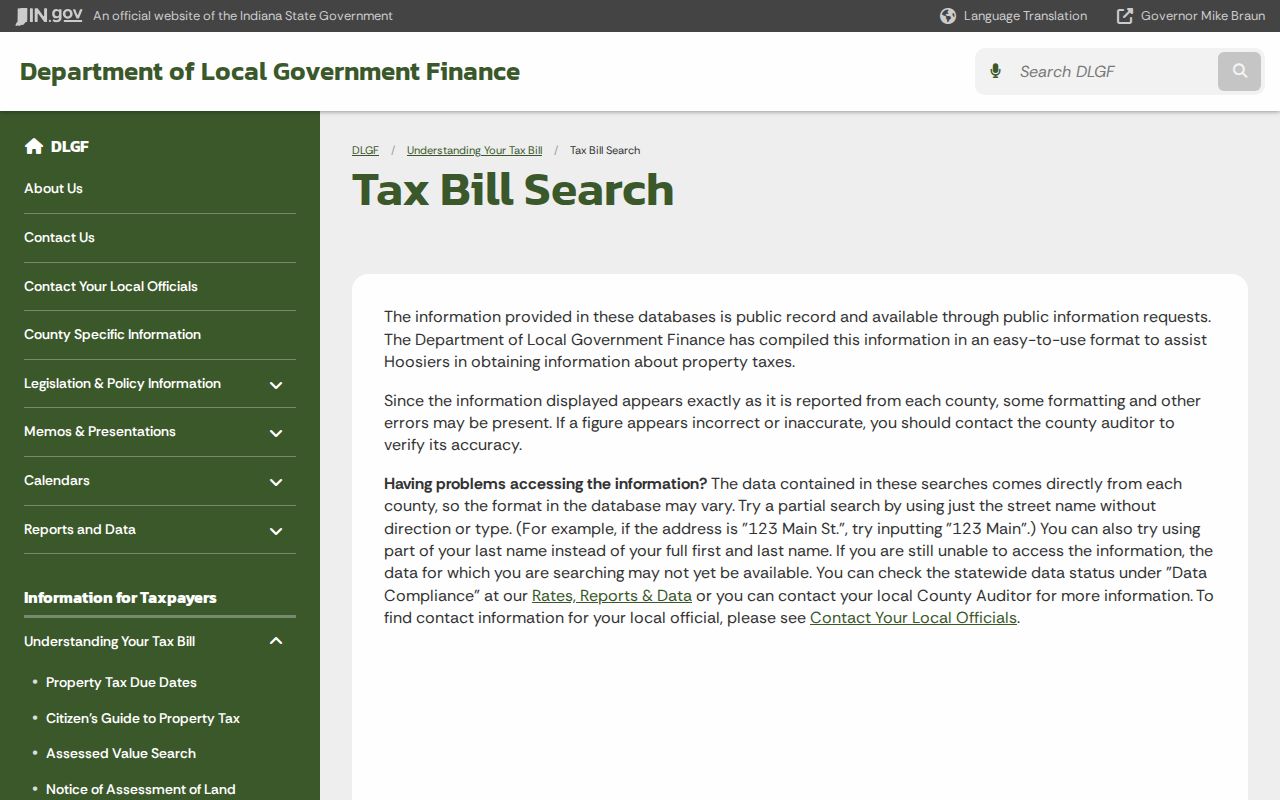
The statewide Indiana Department of Local Government Finance Tax Bill Search reaches county-submitted property data and suggests partial street or surname searches when formatting blocks a match. It is not a replacement for the county card; county data can be unavailable or need correction.
The four modes below come from the inspected Indianapolis/Marion County property-card interface. They model local search fields, not a promise that all 92 counties use the same form.
The statewide lookup instructions show how name and address formatting can affect a result:
Use the county assessor or auditor to resolve a missing parcel, correct a data issue, or inspect the current record.
| Marion Model Field | Type | Required | Format or Use |
|---|---|---|---|
| Parcel Number | Text | For this mode | Sample instructions expect seven digits. |
| State Parcel Number | Text | For this mode | 18-digit number beginning with 49; it may display in segments. |
| Owner Name | Text | For this mode | Accepts all or part of a name; a common surname can return more than one parcel. |
| Address | Autocomplete | For this mode | Select a suggested address, then confirm the situs line on the card. |
Parcels Along an Indiana Map Street
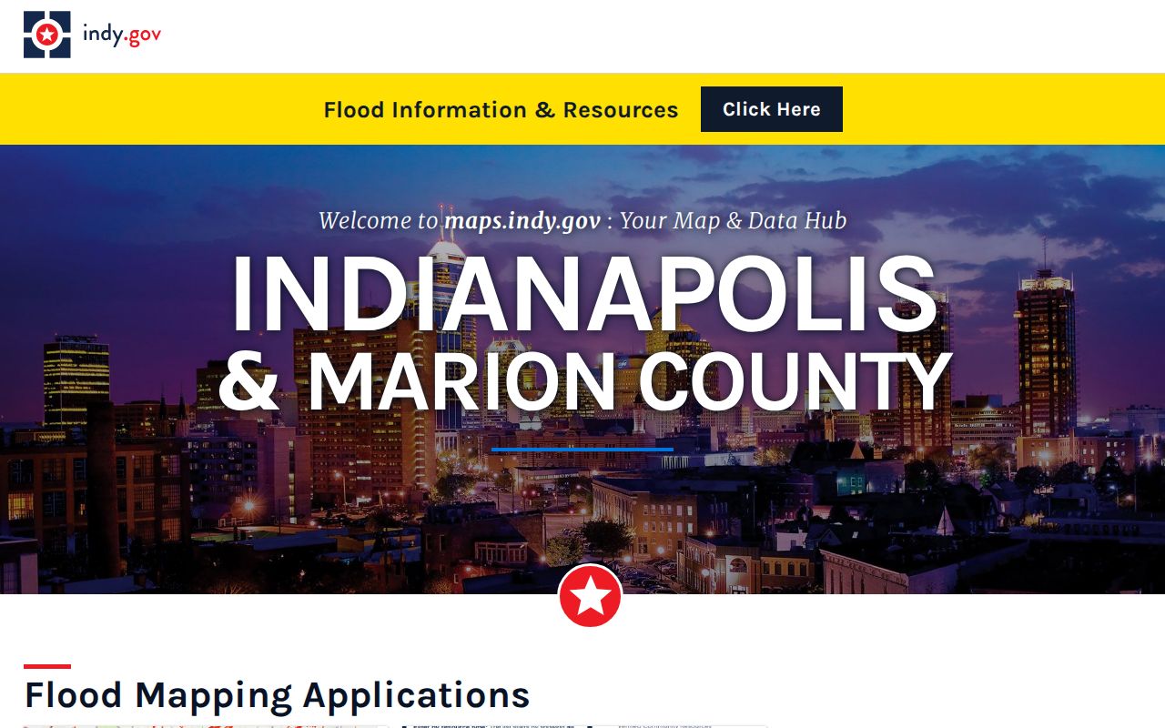
Local map tools turn an address into a parcel shape. In Indianapolis/Marion County, MapIndy links to property cards and map applications; its help page describes address or parcel search, historic and oblique views, measuring, selecting, printing, and moving between map tools. A street browse can show the next parcel, but the card for each parcel must still be opened and checked on its own.
The Indianapolis local GIS hub is a model for the separate map and property-card tools a county search may use:
For statewide context, IndianaMap brings together parcel, address-point, and street-centerline layers contributed through county data harvest. The 2025 Data Harvest release describes current statewide geospatial data, while counties remain stewards of their parcel records. Use the local viewer for current tax or title questions; use IndianaMap to compare geography across county lines or obtain statewide context.
Layers can include parcel identifiers, addresses, districts, zoning, flood context, historic resources, and utilities, though fields differ. A map can help assemble a street’s parcels, but it is not the official answer to a boundary or ownership dispute.
Indiana Street Records: Two Addresses
A property card may show a situs or property address and a different owner mailing address. The situs address points to the parcel’s physical location. The mailing line is where the tax notice goes, which may be another street, city, state, or post office box. These fields answer different questions, and an address search can mislead if they are treated as one.
This Indiana assessor-card detail helps with follow-up searches. A mailing address may belong to a trust, estate, company, tax agent, or other owner. It distinguishes the tax record from the site but does not prove the owner lives there. A homestead deduction shows a qualifying claim was filed, not continuous presence. Keep the address lines separate and use the legal description and parcel identifier to link a card to its deed.
- Parcel
- A mapped unit of land with its own assessor identifier and property record.
- Situs address
- The street address assigned to the physical parcel.
- Plat
- A recorded map that lays out lots, blocks, streets, and other subdivision details.
- Criss-cross directory
- A directory arranged so a street address can lead to a named resident or business for a particular year.
What Indiana Parcel Cards Record
The Marion County model card is labeled as a 2025 card. Its fields distinguish a parcel from the owner named on it, and can include:
- Owner name, county, township, corporation or district, account number, and parcel identifiers.
- Separate property and mailing addresses, plus the legal description, plat, map, tax district, and neighborhood code.
- Property class and subclass, assessment year, land and improvement values, and a valuation record.
- Transfer rows with a date, grantor, validity flag, consideration amount, and instrument type.
- Land characteristics such as topography, utilities, road and sidewalk details, neighborhood condition, and sketch or area measurements.
- A printable report and sketch addendum; the card itself does not contain the deed image.
These fields describe the parcel and assessor record, not everyone connected to the address or day-to-day occupancy. Confirm any transfer in the recorder’s instrument rather than treating the card summary as the title chain.
Indiana Street Directory Record Types
Indiana custodians add different address facts: the assessor or auditor keeps parcel and tax data, the recorder indexes instruments, local agencies hold permit and code files, and libraries preserve historic address tools. None is a statewide occupant list.
| Address-Keyed Record | Keeper | What It Can Show | Access Route |
|---|---|---|---|
| Property card | County assessor/auditor | Owner, situs and mailing lines, parcel, legal description, value, transfers | County portal or office; DLGF is an aggregate search. |
| Tax bill or sale record | County treasurer/auditor | Tax year, installment, payment or delinquency context | County portal or custodian. |
| Deed index and instrument | County recorder | Grantor, grantee, date, document or book/page, legal description | County index or vendor, public terminal, or recorder counter. |
| Parcel map | County GIS / Indiana GIO | Parcel shape, address point, adjacent lots, and selected layers | Local GIS viewer or IndianaMap. |
| Permit or code case | City or county office | Address, case type, status, date, and sometimes a named applicant | Local portal or a particular public-record request. |
| Voter status | County election office / Indiana Election Division | Individual registration and polling details within the public lookup | IndianaVoters self-check; other file access has statutory limits. |
| Street-indexed directory | Public or historical library | A named resident or business at an address in a particular year | Collection page, print, microfilm, or a digitized volume. |
| ZIP check | USPS | Postal delivery city and ZIP for an address | USPS address lookup; it does not confirm a person is there. |
Carry the parcel number and legal description from the address search into deed or permit checks. A tax bill gives tax status, a map gives location context, and a directory records an older name-address pairing. None alone proves who lives on a street today.
Tracing an Indiana Deed Chain
Search the current owner as grantee near the transfer date. A purchase deed lists grantor, grantee, recording date, instrument type, legal description, and document or book/page number. Search the prior owner as grantee, then compare the description again. For a subdivision, match plat, lot, and block; for metes-and-bounds land, check survey calls and references instead of relying on the street label.
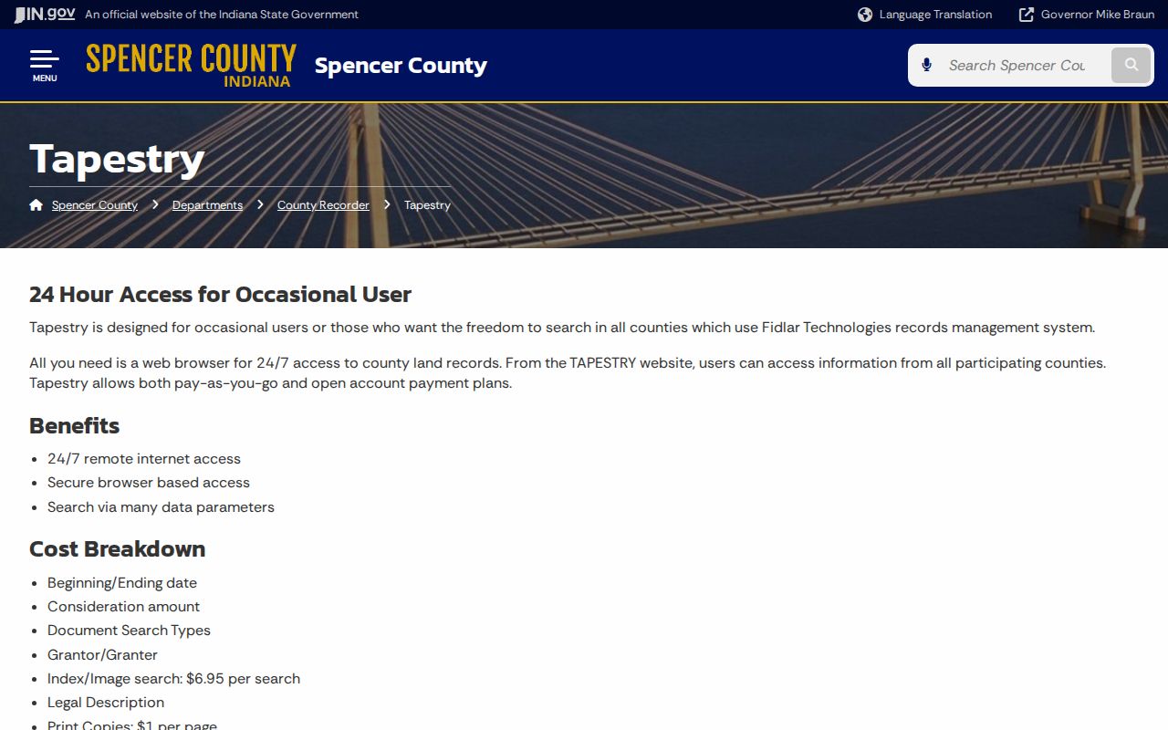
A county recorder’s web vendor is one access path. Spencer County’s Tapestry instructions list date range, consideration, document type, grantor/grantee, and legal-description searches. Spencer County states a $6.95 index/image search and $1-per-page prints, with Laredo as a subscription option. Those are local terms, not an Indiana-wide fee schedule.
The Spencer County recorder page shows one county’s public instructions for the Tapestry index and image search:
Keep the recording reference if an image is not online. If a vendor search ends too soon, ask the recorder about grantor/grantee books, the plat index, older volumes, a public terminal, or staff help. The recorder confirms the official instrument and provides certified copies.
Old Indiana Street Numbers
A present address may not match an older street number or name. The State Library lists Indianapolis directory maps from 1880, 1881, 1883, and many years from 1894 to 1909. Maps, plats, and Sanborn block numbers help bridge old labels to current parcels. Across Indiana, annexations, local boundaries, road renames, rural-route changes, and postal city labels add variation.
Indianapolis Haines criss-cross volumes run from 1940 through 1988, with gaps and title changes. They bridge an address to a named occupant in a given year, not ownership. The digitized Indianapolis City Directory Collection spans 1855–2001, also with annual gaps. The State Library’s county-organized guide lists local holdings, including its Sanborn map resources. Full historical collections belong on the Indiana city directory collection page; the street directory uses them to resolve address continuity.
Indiana Voter Records by Address
IndianaVoters is a person-centered check, not an open street-by-street voter directory. The public registration search asks for first name, last name, date of birth, and the county of current registration; an Indiana driver-license number is optional. The county and precinct browse helps with election geography, but it does not return a reverse list of voters on a block.
Indiana’s full voter file uses statutory request channels. The VRG-24 form names eligible requester categories and asks what county-wide, township, precinct, history, registration, or walking-list data is sought. Restricted statewide copies redact date of birth and gender, while qualifying subscribers have a separate annual-file route. The ordinary lookup should be used for an individual’s own status and polling information; do not assume it can disclose a street’s registered households.
Address Confidentiality Program participants can ask the county to flag a voter record. The Indiana Attorney General’s program gives eligible participants a substitute mailing address, and flagged voter data is not open for public inspection or copying except through narrow legal channels.
Indiana Permits Add Dates, Not Residents
Permit and code systems may search by address, case number, category, status, or date; some rows name applicants. Fields and start years vary by city or county, and no statewide index exists. A case dates work or a violation, not who occupied or acted unless the record names them.
Outside Indianapolis/Marion, route to the city or county custodian. That inspected model has service cases and a code GIS table, while other places use different portals or office files. If no portal result appears, request a specific record with enough detail to identify it.
When an Indiana County Index Ends
Indiana has no single statewide recorder portal, and the online cutoff for a deed index was not located in official statewide sources. Vendors and image coverage vary by county. A county may have Fidlar Tapestry, Laredo, another public index, or a paper and microfilm sequence. A result that is not online can still be held by the recorder, and a public index may lead to a copy that has a separate fee.
Use the Indiana county directory to identify the government for the address, then contact that county’s recorder, assessor/auditor, clerk, election office, or library as needed. The State Library’s county guides and Indiana Archives and Records Administration catalog offer paths to county books, microfilm, and historical holdings. IARA’s county retention schedules show which local record series are preserved; ask the custodian where a particular volume is kept.
Under Indiana’s Access to Public Records Act, a request should identify an existing record with reasonable particularity. An agency need not create a new list of every owner or former occupant along a street. The county holding the record decides what index, copy, or older volume is available.
Where an Indiana Street Directory Stops
Public parcel and deed records can show an owner or a transfer, while other names may not appear in those filings. A person listed as owner may not be the sole person connected with the address. Utility customer information, postal delivery data, and motor-vehicle address records are not open substitutes for a public street lookup. Voter records can be confidential, court files may be sealed, and private association member lists are not implied by a public boundary map.
Use records for personal, lawful research and verify uncertain details with the office that holds them. Indiana’s stalking law covers a repeated course of conduct that causes a person to feel threatened or intimidated. A public record does not grant permission to follow, threaten, expose, or harass anyone.
Privacy and lawful use. Keep a search focused on a legitimate personal or civic question, and do not use public address records to stalk, harass, threaten, or expose another person.