
Indiana ZIP Code Families and Their Coverage
Indiana ZIP geography is too broad for one short list to stand in for the full delivery roster. The state’s 2021 map page points to an Excel crosswalk by county and township; it does not publish a transcribed all-ZIP roster in the research used here. These examples show how the source groups regional coverage. They are not a complete or current ZIP list, and the post-office name for a particular address must be checked through USPS.
| ZIP family or example | Indiana areas represented | Post-office name | Coverage note |
|---|---|---|---|
| 460xx–461xx | Central Indiana, including Anderson, Carmel, Fishers, Greenwood, Plainfield, and Zionsville | Check USPS for the address | Town, county, and delivery names can differ. |
| 462xx examples: 46201–46205, 46208, 46214, 46217–46229, 46231, 46234–46241, 46250, 46254, 46256, 46259–46260, 46268, 46278 | Indianapolis and Marion County delivery areas | Indianapolis is a mailing city for some addresses; verify each one | Several areas are in the consolidated city-county, alongside excluded cities and nearby county addresses. |
| 463xx–464xx | Northwest Indiana: Gary, Merrillville, Michigan City, La Porte, Valparaiso, Lake and Porter areas | Check USPS for the address | ZIP areas can cross county or incorporated-city lines. |
| 465xx–466xx | North-central Indiana: South Bend, Elkhart, Mishawaka, Plymouth, Warsaw, and Goshen | Check USPS for the address | Preferred postal city names may differ from municipal address wording. |
| 467xx–469xx | Northeast and east-central areas, including Fort Wayne, New Haven, Huntington, Marion, Kokomo, and Logansport-area delivery | Check USPS for the address | Rural route and township context calls for address-level map checking. |
| 470xx–473xx | Southeast and east-central towns, including Ohio River communities, Richmond, Connersville, Muncie, and a Terre Haute-region overlap | Check USPS for the address | A ZIP alone does not establish a county. |
| 474xx–476xx | Bloomington, Bedford, Columbus-adjacent areas, Vincennes, and southwest Indiana | Check USPS for the address | PO-box and unique codes may not map to a residential polygon. |
| 477xx–479xx | Evansville, Jasper, Terre Haute, Lafayette, West Lafayette, and rural areas in several regions | Check USPS for the address | Use local parcel search after confirming the postal address. |
| PO-box or unique ZIPs | Box service and single-institution mail throughout Indiana | Use the USPS ZIP-to-city mode | Not evidence of a residential neighborhood or person. |
Indiana spans delivery areas with different post offices, suburban boundaries, rural addresses, and special-use codes. No row above assigns every ZIP to an incorporated city or county. Use USPS for the live address match, then read the 2021 crosswalk as a geographic aid rather than a current postal authority.
Finding a Record After Checking an Indiana ZIP
A ZIP narrows geography, but it does not unlock a statewide list of residents. IndianaVoters is an individual confirmation tool, and the Marion County assessor interface inspected in the research offers address, parcel, state parcel number, and owner-name modes rather than a primary ZIP search. Features vary by county, so keep the task to one known address or record instead of assuming every office can search a ZIP-wide roster.
- Enter the complete street address in USPS and record the returned ZIP and preferred mailing city.
- Use the county or township crosswalk to identify possible local jurisdictions; confirm the parcel’s actual county with its address or legal description.
- Search the county assessor or GIS for the parcel, using address, owner, or parcel fields available in that county. A tax record is about a property owner, not every occupant.
- For voter information, use IndianaVoters for the person’s own registration and polling place. Contact the county election office for corrections or a permitted specific record.
- If an existing public record is not online, make a particular APRA request to the office that holds it; a ZIP is not a request for a new resident list.
The USPS ZIP Code Lookup separates address, city-and-state, and ZIP-to-city searches:
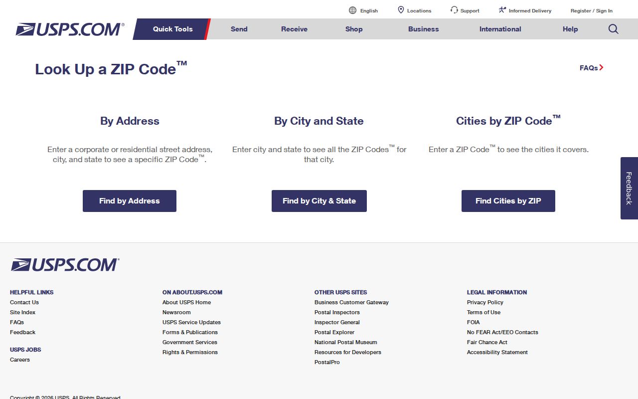
Use the full-address mode for a specific destination, then treat a returned city name as postal routing information rather than a municipal boundary.
Once the postal code is checked and the address is known, the Indiana by-street record path is the better way to follow parcel, assessor, and deed records.
The 2021 Indiana ZIP Map and County Crosswalk
STATS Indiana’s ZIP map page links an interactive 2021 boundary map and Excel files that cross-reference ZIPs with Indiana counties and townships. Use the spreadsheet to see which local areas touch a postal code, and the map to view the drawn geography. The file is a dated reference, not a live delivery verifier. The research did not transcribe every ZIP row from that spreadsheet, so it would be misleading to turn the selected examples above into an exhaustive state roster.
That distinction matters for statewide lookups. A postal code can cover pieces of more than one county, while the county that holds a parcel card or deed is determined by the parcel and its record office. The ZIP-by-county crosswalk can help select a likely office; it cannot certify which county owns a specific parcel without the address or legal description.
Indiana ZIP Boundaries and Government Lines
A ZIP is a delivery grouping, while a city, county, or township line is a government boundary. One city may have several ZIPs; one postal city can serve unincorporated land or more than one town. Indianapolis mailing names can appear on addresses outside incorporated Indianapolis, while Marion County delivery groups include excluded cities. Do not assign a government office from the ZIP alone. Use the address, postal verification, and parcel jurisdiction together.
- ZIP and ZIP+4
- A ZIP is the postal delivery code; the added four-digit segment narrows the delivery route within the code.
- PO-box ZIP
- A code assigned to post-office box delivery rather than an ordinary street-address area.
- Unique ZIP
- A code set aside for a single institution or organization; it may not describe a residential polygon.
- Carrier route
- A postal delivery grouping within a ZIP, not a city, township, or county boundary.
Postal geography. A USPS city name is a mail-routing choice. It does not prove that an address lies within that municipality or identify who lives there.
Central Indiana ZIP Families Include 462xx
The central family ranges from 460xx and 461xx communities to Indianapolis-area 462xx delivery zones. Research examples include Carmel, Fishers, Greenwood, Plainfield, and Zionsville, as well as Anderson and nearby central counties. The names describe regional orientation, not an exact border. A ZIP can serve unincorporated land or a town outside the mailing city printed on an address.
For Marion County, an official state service-area list groups examples such as 46107, 46113, and many 462 codes together. That grouping shows why a “Marion ZIP” list is not the same thing as a city limit: the county contains the consolidated city-county, excluded cities, suburban edges, and rural pockets. It is a service-area illustration, not a postal boundary source. Check an address with USPS, then use the relevant local parcel map or office.
Northern and Southern Indiana ZIP Families
Northwest Indiana’s 463xx–464xx examples include Gary, Merrillville, Michigan City, La Porte, and Valparaiso across Lake and Porter areas. North-central 465xx–466xx examples include South Bend, Elkhart, Mishawaka, Plymouth, Warsaw, and Goshen. These labels help orient a search toward a county map or library guide, but a postal area can cross county lines and its city name may not match an incorporated place.
Farther east, 467xx–469xx families include Fort Wayne, New Haven, Huntington, Marion, Kokomo, and Logansport-area delivery. The 470xx–473xx range covers southeast and east-central examples such as Ohio River towns, Richmond, Connersville, Muncie, and a Terre Haute-region overlap. In the south and west, 474xx–479xx groups include Bloomington, Bedford, Vincennes, Evansville, Jasper, Terre Haute, Lafayette, and West Lafayette. Rural routes add township context that a mailing city alone cannot supply.
Use those ranges as pointers into the STATS Indiana map, not as a claim that each town occupies every code in its family. If a county name matters, use the crosswalk and confirm the specific parcel through county GIS or the assessor.
IndianaMap Shows Parcel Geography, Not Residents
IndianaMap and the Indiana Geographic Information Office provide statewide geographic layers and county parcel data through Data Harvest. The statewide parcel view is assembled from county data, while counties retain data stewardship. This helps when a postal code overlaps a township or county and the next question concerns a parcel, road, or boundary.
Recent parcel and administrative-boundary releases improve geographic context, but they do not replace a county assessor’s card, recorder’s instrument, or election office’s record. A GIS polygon can guide a search; the local custodian confirms the record and its legal meaning. Map labels may generalize or lag local changes, so note the layer date before relying on a boundary.
Check Indiana ZIP Changes Against the Date
Postal areas and city associations can change as delivery operations change. Research located USPS PostalPro boundary products but did not verify an official statewide year for a historical ZIP split or realignment. The 2021 Indiana map is therefore a dated geographic snapshot, not evidence that every boundary or preferred city name remains current.
For a current mailing question, repeat the full-address check in USPS. For an older deed, voter record, directory entry, or family paper, preserve the address wording and the record date, then use the local county or library source that fits that period. The Indiana ZIP code directory examples above are an orientation aid; the spreadsheet/map and live postal lookup answer different parts of the question. Keep the map date beside any comparison so a postal change is not mistaken for a move or a government-boundary change.